Unmanned systems
Originally published March 30, 2020 on my earlier blog; republished as written.
For this week I developed and tested a UAS using the ERAU Virtual HUB program. I chose the “missing hiker” scenario. To look for the missing hiker, I determined that I would like an Unmanned Aircraft System (UAS) that covers large areas of land quickly and I selected an infrared camera for the search.
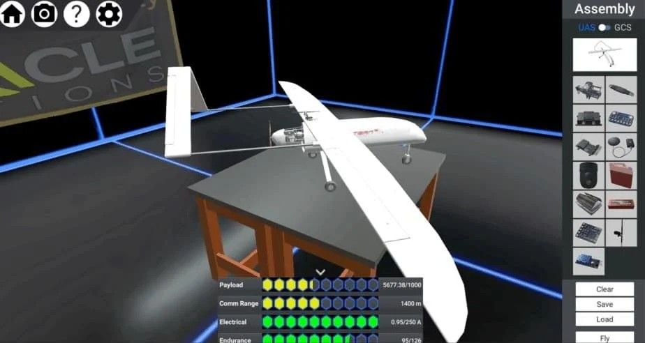
The Control Station (CS) I chose was the camper van. My Initial design used the Tern Fixed wing with autonomous flight, however, after trying both manual and autonomous, I found that it was critical to have the capability to change my flight path in real-time while searching for the hiker. The autonomous flight path planning would require taking off and fly the route and land to reprogram the UAS when I did not find the hiker. With manual flight, I was capable of continuing the flight across the area for an extended period before finding the hiker.
I realized I had difficulty maneuvering the camera while flying the aircraft consistently enough. Whenever I was ready to look at something, the camera kept tracking along the ground with the aircraft. I believe an area for a human factor improvement would be having the camera maintain the location on the ground-based on the latitude and longitude while keeping the camera stationary instead of traveling along the route of flight.
I then switched to the Gannet Rotary-wing. The rotary-wing provided the capability to travel long distances, climb to high altitudes, while having the capacity to stop moving so I could look around with my infrared camera.
With both the rotary-wing and the fixed-wing, I found that while manual flying, I did not have a view of the map of the area in which I was flying. This made it difficult to manage the area of my search. To improve this area, I would have at least a small map on the user interface to allow the pilot to see where the aircraft is from a birds-eye view.